Make field variation visible
Aerial imagery provides a wider view of a plot and helps identify areas that need closer inspection.
LOCALLY DEVELOPED UAV TECHNOLOGY · DHAKA, BANGLADESH
Locally developed UAVs and AI-assisted crop insights for more precise rice farming in Bangladesh.
Active field validation · Human-reviewed decisions
RECOGNIZED IN 2026
Champion — Resilient Food FutureYouth-Led Sustainability Action Research
ActionAid Bangladesh
SustainLaunch Labs
01 / THE CHALLENGE
Rice fields are not uniform. Crop stress and disease indicators can vary within the same plot.
Manual inspection demands time and effort, while broad spraying can apply inputs to areas that do not need the same response. For smaller farms, those decisions affect both costs and resource use.
AgroFlight is developing a more informed approach: observe the field, review the evidence, and focus the response where it is needed.
Aerial imagery provides a wider view of a plot and helps identify areas that need closer inspection.
AI-assisted screening brings possible disease indicators to an operator’s attention for review.
Targeted treatment is designed to reduce avoidable application and improve resource efficiency.
02 / HOW IT WORKS
One integrated framework connects two UAV platforms with a ground-based analysis station.
The scanner collects aerial crop imagery and flight data, bringing a field-wide view to the ground platform.
Output: imagery & flight recordsModels screen images for crop stress and disease indicators. An operator reviews the findings alongside ground observations.
Output: reviewed findings & target areasAfter treatment is approved, the spraying platform supports a focused response in selected areas of the field.
Output: supervised, targeted applicationA model indication starts a review. A human operator approves any treatment decision.
03 / THE PLATFORMS
Purpose-built roles for crop observation and selective application, connected through a ground analysis workflow.
OBSERVE / SCANNER UAV
The scanner UAV collects aerial crop imagery and flight records. Raspberry Pi-based image acquisition and Pixhawk telemetry integration connect visual observations with flight context.
RESPOND / SPRAYING UAV
The spraying UAV is designed for targeted treatment of selected crop areas. It turns reviewed findings into a supervised application workflow, with the aim of reducing unnecessary pesticide and input use.
ENGINEERING THE CONNECTION
Explore the capture, screening, and response layers behind the field workflow.
CAPTURE & DOCUMENT
The scanner platform captures crop imagery and records flight metadata. Raspberry Pi 5 processing and Pixhawk flight control support the capture workflow.
Research focus: image quality, useful coverage, and reliable field records.
SCREEN & REVIEW
The ground platform processes imagery, assesses visual crop stress, and brings disease-screening classifiers and detectors together with image review. Wireless transmission connects field capture with the dashboard.
Model indications require field verification; performance depends on image quality and capture conditions.
PLAN & RESPOND
The spraying platform connects operator-reviewed crop observations with supervised application in selected areas. Field validation benchmarks the workflow against conventional farming practices.
Research focus: repeatability, application control, and comparison with conventional practice.
THE GROUND PERSPECTIVE
The interactive crop-monitoring dashboard brings field boundaries, imagery, AI-assisted screening, and location information into one workspace for operator review.
Screenshots from our September 2026 dashboard. This is a product preview.
FIELD NOTES / IN PRACTICE
A closer look at our UAV prototype, flight demonstrations, and rice-field observations, captured by the AgroFlight team.
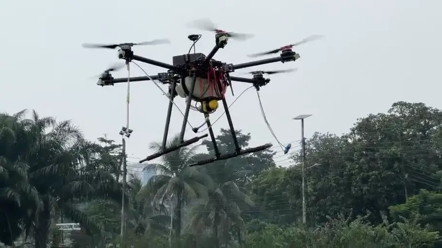
A close-up view of the UAV platform during an outdoor flight demonstration.
An extended recording of the prototype operating over an outdoor test field.
The flight demonstration viewed from the ground.
On-site observation alongside a rice plot.
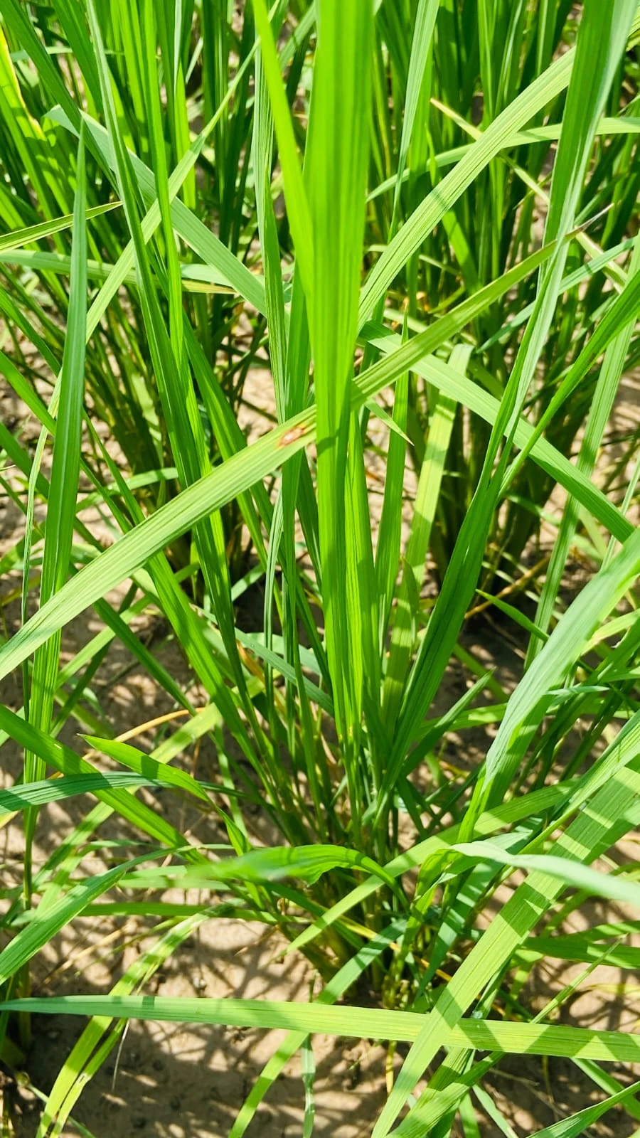
Close-up crop imagery complements the aerial perspective during ground verification.
04 / IMPACT & RECOGNITION
Our mission is to make precision agriculture accessible to smaller farming operations in Bangladesh.
INPUT REDUCTION
Pending validationField result placeholder · Compare conventional application with the targeted workflow.MONITORING TIME
Pending validationField result placeholder · Compare manual inspection time with UAV-assisted monitoring.SCREENING AGREEMENT
Pending validationField result placeholder · Compare model findings with ground-verified observations.These results will be updated after evaluation of the field trials.
05 / RESEARCH & VALIDATION
We’re investigating how aerial observation and targeted response can become a useful, affordable agricultural service.
CROP MONITORING
Compare AI-assisted observations with close-up images and ground inspection, including missed symptoms and false detections.
Detection agreement · Image qualityRESOURCE USE
Compare conventional practice with a targeted workflow to evaluate monitoring time, application volume, and operational effort.
Time · Application volume · CostPRACTICAL ADOPTION
Study understandable reports, operator support, affordability, and feedback from farmers and agricultural stakeholders.
Usability · Affordability · FeedbackActive field validation of the integrated crop-monitoring and targeted-treatment framework, benchmarked against conventional farming practices.
BEYOND THE CURRENT PILOT
The rice-field programme is a practical foundation for locally developed UAV design, autonomous sensing, and applied aerospace research. These are longer-term ambitions that build on the evidence and engineering experience of the current work.
Aerial images cover a wider area, while close-up observations reveal finer symptoms. Combining both helps us assess whether a model indication reflects a real crop issue.
Our current work centres on AI-assisted screening and supervised spraying workflows. Crop observations are reviewed and verified before treatment decisions.
We welcome discussions on field trials, agronomic verification, UAV systems, and evaluation methods. Contact the team to explore a research or demonstration collaboration.
06 / ABOUT AGROFLIGHT
AgroFlight is a precision-agriculture technology initiative based in Dhaka, Bangladesh. Our multidisciplinary team brings UAV engineering, computer vision, AI, and agricultural field research together to make precision agriculture more accessible to smaller farming operations.
07 / GET INVOLVED
Farmers, researchers, institutions, investors, and technology partners — bring your questions and ideas to the field.
musfiqur@agroflt.comDhaka, Bangladesh